
For many, mapping is an unsuspicious technique that helps us orient ourselves in the world. What is often overlooked is that it matters a little which political agendas are being served by mapping. Even the global industry of "counter-mapping", which remains partly useful to resist encroachment aided by conventional mapping, have begun to adopt the spatiality, temporality and logic of change that underlies hegemonic mapping. In quite a number of regions, participation and shareholding in the mining and plantation industry or in REDD and other carbon offset projects substitute the logic of resistance and healing supposedly served by participatory mapping. A critical story of the "mapping from within" movements —as opposed to the hegemonic "mapping from without" industry— must therefore be embedded in social learning agendas to support real change.
The past four decades have seen dramatic changes across the global South. Amid an increasingly integrated global energy and materials economy, well-financed businesses have rushed to occupy new or potential value-producing sites. Production has been fragmented and redistributed, trade patterns disassembled and re-organised, and national states reconfigured in response. As the slogan “Made in the World” replaces older labels like “Made in Germany” or “Made in Japan”, new and accelerated forms of ecological and social deterioration have emerged.
One part of these shifts is a change in mapping. In the past, the presentation of land on maps was often a way of helping businesses and states claim territories and organise the knowledge needed for capital accumulation. It often disregarded “other” claims and knowledges considered irrelevant.
Capitalist mapping extends and transforms military logistics. Such mapping is getting more specialised and narrower in its disciplinary background not only by accumulating knowledge that is deemed useful for the reproduction of the global economy, but also by simultaneously dismissing or condemning any "other" knowledge considered irrelevant. Today, mapping is on the whole becoming perhaps even less democratic and even more elitist and exclusionary – even further removed from the concerns of the weakest social groups. Investors and political leaders consult global maps revealing where “shrinkage of food-producing regions” is “tolerable”. Where “tropical forest carbon stocks” can be annexed most cheaply. Where agricultural land has the lowest or highest dollar value. Where new “corridors” facilitating streamlined trade and production can be most easily cut across thousands of kilometres of political and topographical boundaries, reorganising both human and nonhuman communities in their wake. Bringing "development" to those affected by the large-scale investment prepared by such maps is usually cited in defence of the destruction.
Within half a century since the late 1960s, such a vigorous re-mapping of the world has nurtured confidence across a broad political spectrum —including some within the environmentalist movements— in the utility of such reductionist "geographies".
State-driven “spatial planning” maps areas outside existing investment blocks or in already built-up areas that can be ravaged at the least political cost, in order to make them available for the next round of international investment. Drones and satellites help states and businesses achieve profitable sub-meter accuracy in the spatial representation of everything from soil types to legal boundaries.
Meanwhile, local communities find it hard to get recompensed for invasions of their territories when the maps used by their investor and state adversaries are incapable even of recognizing what they need to be compensated for.
Alternative Spaces
Yet even the most powerful and systematic attempts at remapping the earth for a new wave of plunder produce their own nemesis. Every attempt to expand the boundaries of monopolised space to generate more economic value provokes efforts to define, defend, reclaim and recreate “alternative” spaces.
Such spaces can be found not only at big events like World Social Forums in cities such as Porto Alegre, Mumbai or Tunis. They are also being recreated in many places where people’s commons are being eroded and who are trying to reconnect with their own forests, mountains and soil.
Potentially, such "alternative" spaces might also be built out of the often-ignored transient lifespaces of the newly dispossessed, including urban squatters, oppressed factory workers and rural refugees. In such groups, the sense of community often gets invoked only in emergency situations, such as threatened evictions, manifesting itself in uprisings or riots. But out of these emergency situations also emerge untelevised and unfunded spaces for long-term collaborative learning – for re-planting devastated land, growing crops to meet communities' internal needs, and so forth. Such efforts are ways of regrowing some of the organs we need to move forward.
Alternative Mapping
Attempts to map such spaces can potentially help carve out new arenas for challenging capitalist expansion. But they can also end up themselves serving global corporate or imperial interests.
“Counter-mapping” and “participatory mapping” are examples. Counter-mapping typically enlists the help of professionals to create maps that better represent ordinary people's interests and concerns, while participatory mapping often relies partly on information that only local people can provide.
Such efforts are frequently well-intentioned. But they can also reproduce the discriminatory ways of thinking about space that characterize dominant maps.
For example, they may filter out the voices of those that are not capable of using the mapping technologies, or ignore the vocabularies they use. They may represent local lifespaces as locations on a property or prospecting grid, contradicting what defines those lifespaces. Even where they attempt to depict the extent of the invasion of ancestral lands or the spread of resistance movements, they will probably be unable to probe, let alone represent on a one-dimensional map, very deeply the nature of the underlying conflicts.
In addition, “alternative” mapping efforts may end up serving as sources of commercially-valuable information that states and corporations find hard to acquire, like the GPS locations of cliffs that match the colour of specified mineral samples, or knowledge about local conservation practices that can be later commodified and sold, e.g. under REDD+ schemes.
In Indonesia, for instance, Constitutional Court Decision 35 of 2013 mandated state recognition of "customary forests" to customary territorial maps. This gets mapped and administered in tandem with communities participation in REDD. By the end of 2014, the Indonesian Indigenous Peoples Alliance (AMAN) had submitted 517 maps covering an area of over 4.8 million hectares to the now defunct Executive Board of REDD+, which had assumed a role of geographical "data caretaker."
In the worst cases, “participatory” mapping degenerates into sheer manipulation. In one notorious Indonesian example, the World Wide Fund for Nature (WWF) lent 50 video cameras to community members in Lamalera, Lembata Island and conducted local trainings in video-making. The community then used the cameras to record a partly-ceremonial, non-commercial annual whale hunt in the island's coastal waters. After taking back the cameras, WWF used the footage to discredit the Lamalerans and to propose a government ban of such rituals, without any effort to analyse and understand the social history of the Lamalerans,
Ways Forward
In our efforts to challenge or “decentre” a resurgent colonialism's aggressive re-mapping of the world, we can learn a lot from well-established alternative ways of organizing space and time.
The Balinese cosmos, for instance, integrates not only spatial cardinality, such as compass directions, with virtue, colour and degree of sacredness, but also connects cosmic events, profane and sacred human activities, and a sharp and accurate understanding of ecological lifespace with a hybrid calendric system. Such a hybrid system incorporates both the lunar and solar calendars, and includes the Gregorian, Hijri, Chinese, Wuku and Çaka calendars. The idea is to calibrate temporal cycles of social or ceremonial routines according to the virtues offered by climate and microclimate dynamics. Today, for example, residents of the four communities guarding Tamblingan Lake understand and live in accordance with a detailed mental map of the landscape based on a set of environmental laws in the form of inscriptions dating back to 480 AD.
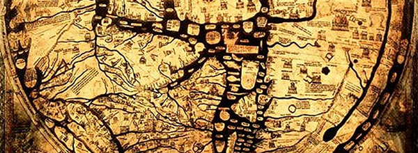
Mappings of space associated with (for example) the two millennium-old Shan Hai Jing (the Classics of Mountains and Seas) or the mappamundi of medieval Europe provide more tools for a critical analysis of contemporary capitalist mapping.
Resistance, healing and re-commoning will require collective efforts in understanding and exposing today's brutal extractivism. It this context, it is important to highlight the role mapping – including many forms of participatory mapping – plays in aiding continued extractivism. But resistance, healing and re-commoning also requires different kinds of mapping that bring into play codes and rationalities distinct from those that dominate capitalist geography, regarding the use of space, working-time, energy and the earth's materials.
Hendro Sangkoyo, hendro.sangkoyo@gmail.com
School of Democratic Economics
More reading:
(1) Dorofeeva-Lichtmann, Vera V. (1995). Conception of Terrestrial Organization in the Shan Hai Jing. Bulletin de L'ecole française d'Extremè-Orient, Tome 82, 1995, pp. 57-110, http://www.persee.fr/doc/befeo_0336-1519_1995_num_82_1_2297
(2) Biggs, M. (1999). Putting the State on the Map: Cartography, Territory, and European State Formation. Comparative Studies in Society and History, Vol. 41, No. 2 (Apr., 1999), pp. 374-405, http://users.ox.ac.uk/~sfos0060/statemap.shtml
(3) A.B. Coury, Hendricks, T.A., and Tyler, T.F. (1978). Map of prospective hydrocarbon provinces of the world. U. S. Geological Survey.
(4) Sassan S. Saatchi et al (2011). Benchmark map of forest carbon stocks in tropical regions across three continents, Proceedings of the National Academy of Sciences, http://www.pnas.org/content/108/24/9899.full
(5) World Bank (2011). Rising Global Interest in Farmland: Can it yield sustainable and equitable benefits?http://siteresources.worldbank.org/DEC/Resources/Rising-Global-Interest-in-Farmland.pdf